Simulation-Based Wildfire Spread Modeling Tool for Community-Scale Risk Assessment (SWUIFT)
This technology enables community-scale wildfire risk assessment using a simulation-based model that predicts fire spread and damage wihtin the wildland-urban interface, supporting proactive mitigation and emergency planning.
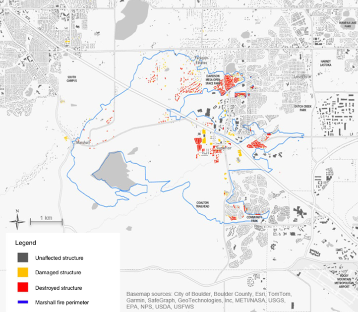
Communities and infrastructure owners currently lack effective tools to estimate wildfire spread and resulting damage at the community scale, particularly within the wildland-urban interface (WUI). Existing wildfire models often focus on large-scale fire behavior or wildland environments andD do not adequately capture fire propagation through built environments. This limitation constrains the ability of planners, utilities, and emergency responders to conduct proactive mitigation, scenario planning, and real-time decision-making. There is a critical need for modeling tools that can simulate wildfire behavior within communities to better inform risk assessment and resilience strategies.
This University at Buffalo technology introduces SWUIFT, a simulation-based wildfire spread modeling tool designed to capture fire propagation within communities. The model represents both urban fuels (e.g., buildings and infrastructure) and vegetation within a unified computational framework, enabling estimation of fire arrival times, spread dynamics, and potential damage. SWUIFT incorporates efficient computational methods and accounts for uncertainties in environmental and structural conditions, allowing for robust scenario-based analysis. The platform supports detailed modeling of fire behavior as it transitions from wildland areas into densely built environments, providing actionable insights for community-level wildfire risk assessment.
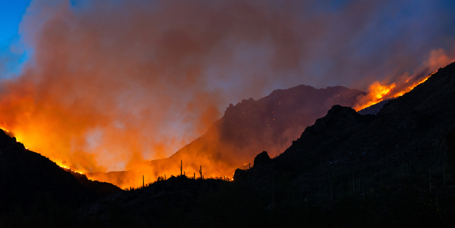 SE Viera Photo, https://stock.adobe.com/uk/images/359013282, stock.adobe.com
This technology provides one of the first explicit simulation frameworks for modeling wildfire spread within communities, addressing a key gap in existing wildfire modeling approaches. By integrating both urban and wildland fuels, it offers a more realistic representation of fire behavior in the wildland-urban interface. The model demonstrates efficient computational performance, enabling practical use in planning and decision-support contexts. It also incorporates uncertainty analysis, allowing users to evaluate a range of possible fire scenarios and outcomes, improving risk-informed decision-making.
This technology can be applied in decision-support software for utilities, municipalities, and emergency management agencies to support wildfire risk assessment, mitigation planning, and emergency preparedness. It is suitable for scenario-based planning tools, infrastructure resilience analysis, and post-fire damage assessment. The platform can also be integrated into broader geospatial and climate risk modeling systems, as well as used in research and policy development related to wildfire management and community resilience.
Provisional patent application 63/965,917 filed January 22, 2026.
Technology Readiness Level 8 (TRL 8)
Available for licensing or collaboration
Patent Information:
| App Type |
Country |
Serial No. |
Patent No. |
Patent Status |
File Date |
Issued Date |
Expire Date |
|