xCITE Mobile Application Network
A framework, codebase and skillset for creating practical, easy-to-use mobile apps based on advanced atmospheric science.
The xCITE laboratory, part of the Atmospheric Sciences Research Center at the University at Albany, uses emerging technologies to visualize and communicate atmospheric research data to a broad audience. One of the lab’s goals is to build apps that help users in a variety of fields – such as government, power distribution, agriculture and transportation – obtain current, reliable and easy-to-consume atmospheric data for use in their operations.
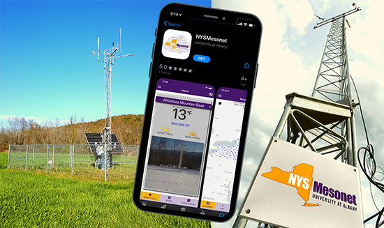
From snowplow drivers to utility repair crews to farmers in their fields, people whose operations depend on weather can keep current, reliable atmospheric data right at hand, with help from new technology developed at the University at Albany. The xCITE Mobile Application Network is a mobile application framework, codebase and skillset for developing apps that seamlessly integrate data from sources such as the NYS Mesonet, OpenWeather Map or Google Maps. The first app built on this framework delivers real time data from NYS Mesonet’s 126 weather stations across New York State, including temperature, wind speed, humidity, snow depth and soil moisture.

![]()
Patent Information:
| App Type |
Country |
Serial No. |
Patent No. |
Patent Status |
File Date |
Issued Date |
Expire Date |
|